On 21 October 2020, the Victorian Government made an announcement which will benefit the hospitality sector after being hit by COVID-19 and ensuring the sector can make a smooth transition to outdoor dining by streamlining planning approvals.
Minister for Planning, Richard Wynne, announced yesterday that existing pubs, restaurants, cafes and other food and drink venues can use existing outdoor spaces, as well as nearby parks and public land to accommodate and serve patrons without the need for a planning permit.
The exemptions being made under planning amendment VC139 will allow venues to capitalise on open spaces including streets, footpaths and carparks to add to venue capacity while restrictions reduce the number of patrons allowed for indoor dining. Businesses covered by the exemptions include restaurants, cafes, bars, hotels, function and reception centres and wineries.
What the amendment does?
The amendment amends clause 52.18 (State of emergency exemption) of Victoria Planning Provisions and all planning schemes to support Victoria’s social and economic recovery from the coronavirus (COVID-19) pandemic through temporary planning scheme and permit condition exemptions that enable outdoor dining and facilitate the reopening and safe operation of restaurants and other food and drink businesses.
The exemptions will operate when a state of emergency declaration under the Public Health and Wellbeing Act 2008 in relation to coronavirus is in force and for 12 months after.
The new planning exemptions will support the hospitality industry by enabling businesses to better plan and use their own land and expand onto adjoining land to accommodate more patrons while the number of patrons is determined by social distancing guidelines.
The new provisions also provide exemptions from the need to obtain planning permits for construction of temporary buildings, the provision of car parking, and the sale and consumption of liquor – subject to conditions.
The amendment includes conditions that limit the hours during which outdoor dining in, or close to, residential zones can occur and require the use of land under the exemptions to not unreasonably affect the amenity of the neighbourhood through noise and other emissions.
Conditions also apply for construction of temporary buildings, limiting the exemptions to temporary and moveable buildings which must be removed from the land before the end of the exemption period and including conditions that limit the height of buildings and require buildings to be set back from adjacent land in a residential zone ensuring the normal planning scheme requirements continue to apply to existing buildings in the Heritage Overlay.
The exemptions apply to permits issued before the approval date of the amendment only, giving businesses more flexibility about how they use their own land in order to comply with public health guidelines. The exemptions will apply while Victoria remains under a State of Emergency, and for 12 months after the State of Emergency has been lifted. Liquor licence, public health matters and public land manager requirements may still need to be met along with council administered local laws.
The full amendment can be view here
The Planning and Environment Division of VCAT is responsible for reviewing some of the decisions made by local councils on applications for the use and development of land, including decisions on planning permit applications under the Planning and Environment Act 1987. During the review process, it is quite often the permit applicants want to change what they have applied for, such as the use and development or the plans submitted with their permit application.
The Victorian Civil & Administrative Tribunal has recently released Practice Note (PNPE9) – Amendment of Planning Permit Applications and Plans with the aim of providing clear guidance on what are the steps required for all parties involved when the permit applicant wants to change their permit application AFTER an application for review has already been lodged at the Tribunal.
The practice note states that if a permit applicant wants to change their permit application after an application for review has been lodged at the Tribunal, then they can only do so if they follow the steps described in this practice note, VCAT will then decide whether or not to allow the changes sought by the permit applicant, usually at the start of the hearing.
The practice note sets out:
- What permit applicants must do when they want to amend their permit application after an application for review has been lodged with the Tribunal;
- What applicants must do if an application is sought to be amended after an application under section 87A of the Planning and Environment Act 1987 has been lodged with the Tribunal;
- What other people must do if they want to become involved in the proceeding as a result of a request to amend the permit application or application; and
- what the Tribunal can do in response to a request to amend a permit application or application.
When does this Practice note apply?
This practice note applies when a permit applicant or applicant wants to amend the permit application or application in the following proceedings under the Planning and Environment Act 1987:
- Section 77 – refusal to grant a planning permit.
- Section 79 – failure of responsible authority to make a decision on a planning permit application within statutory timeframes.
- Section 80 – conditions in a permit.
- Section 82 – decision to grant a permit.
- Section 87A – application to amend a permit that was issued at the direction of the Tribunal.
This practice note does not apply in the following instances:
- Proceedings under other legislation such as environment protection legislation;
- Administrative or corrective amendments to applications, such as amending the name of a permit applicant;
- Circulating draft plans for discussion at a compulsory conference;
- Where the Tribunal has made orders in the particular proceeding which vary or override this practice note; and
- Where notice of the permit application is required but has not yet been given.
What must permit applicants do to amend their permit application?
The practice note lists out the steps as follow:

Just like all other applications with VCAT, documents and notices must be given to all parties involved, such as:
- Responsible authority (Local Council)
- Referral authorities (Such as VicRoads and water companies)
- Other parties to the Tribunal proceeding
- People who have already filed a statement of grounds with the Tribunal, but indicated they do not intend to participate in the hearing.
- People who objected to the permit application, but have not filed a statement of grounds with the Tribunal.
- Persons the responsible authority required to be notified of original permit application.
What does the Tribunal do when it receives a request to amend the permit application?
The Tribunal will normally consider a request to amend a permit application including proposed amendments to plans at the commencement of the hearing. However, an application may be considered earlier than this, for example at a practice day hearing.
In deciding whether to amend a permit application including any plans, the Tribunal may consider the following matters, as relevant:
- the extent and impact of the changes;
- whether all parties and potentially affected persons including referral authorities have been given sufficient time to consider the proposed amendment before a hearing;
- whether the time limits in this practice note have been complied with and any prejudice to a party or potentially affected person arising from any non-compliance;
- whether the amendment improves the proposal or responds to issues that have been raised in the course of the decision making process;
- whether the amendment materially increases the scale or intensity of a proposal or introduces significant changes or new aspects that have not been considered by the responsible authority at the first instance;
- in the case of proceedings under S.80 of the Planning and Environment Act 1987, whether the proposed amendment relates to the condition(s) under review;
- whether the amendment involves the consideration of additional planning controls or policies that were not previously relevant; and
- whether any other circumstances would support the amendment.
VCAT will then decides rather to allow or to refuse the amendment request.
Are you thinking of making an application to VCAT?
The team at CS Town Planning specialise in VCAT representations. For an overview of the formal process of lodging a VCAT appeal or how we can assist you in obtaining the best planning outcome, please visit our website or contact our team of specialists now to discuss your needs.
Today the Minister for Planning introduced a new particular provision, Clause 51.06 Secondary Dwellings, to the Planning Schemes of the Greater Bendigo, Kingston, Moreland and Murrindindi by exercising the Minister’s power of intervention. The Amendment is in response to Victorian Government’s Smart Planning program and Plan Melbourne 2017-2050.
Unlike the standard procedure where an amendment of planning scheme will go through Exhibition stage and Panel Hearing stage. The new clause was introduced directly by exempting the Amendment VC186 from the notice requirements meaning owners and occupiers of land, public authorities and councils that may be materially affected by the amendment did not receive formal notice of the proposed Amendment and were not be able to make submissions in relation to the Amendment and have them referred to a Panel.
It is understood that although The Minister exercised the power of intervention, The Department of Environment, Land, Water and Planning consulted with the City of Greater Bendigo, City of Kingston, City of Moreland, Shire of Murrindindi, the Smart Planning Advisory Group, Smart Planning Technical Reference Groups and a State Government Working Group in relation to this amendment. It is also concluded that Exhibition of the amendment is unlikely to change the outcome of the amendment and immediate implementation ensures that increased effectiveness and efficiency in the operation of the planning system is introduced promptly.
Why is the Amendment required?
The amendment is in response to the 2017 Smart Planning discussion paper, Reforming the Victoria Planning Provisions, which proposed the introduction of new code-based assessment provisions for simple proposals in order to support small business, industry and homeowners. The reform also aims to simplify and modernise Victoria’s planning policy and rules to make planning more efficient, accessible and transparent.
The amendment aims to reduce the regulatory and administrative burden for both applicants and council planning departments, by streamlining the approvals process through the application of code requirements and use of VicSmart. A simplified process will also support the construction and manufacturing industry with positive economic benefits to employment.
The amendment is also in response to Plan Melbourne 2017-2050 which seeks to provide Melbourne with alternative forms of housing, such as secondary dwellings, that can offer opportunity for small-scale development in established areas.
The code aims to facilitate the construction of small dwellings to provide housing options for an ageing population, multigenerational families and lower income households.
How is the Amendment implemented?
The code for Secondary Dwellings will allow the development of a secondary dwelling that meets a range of development standards to be considered through the VicSmart assessment pathway. A pathway that will see decision made within 10 days.
The amendment introduces a code for Secondary Dwellings to facilitate the development of one additional small dwelling on the same lot as an existing dwelling in appropriate residential zones:
- Mixed Use Zone of the Greater Bendigo, Kingston, Moreland and Murrindindi Planning Schemes.
- Township Zone of the Greater Bendigo and Murrindindi Planning Schemes.
- Residential Growth Zone of the Greater Bendigo, Kingston and Moreland Planning Schemes.
- General Residential Zone of the Greater Bendigo, Kingston, Moreland and Murrindindi Planning Schemes.
- Neighbourhood Residential Zone of the Kingston and Moreland Planning Schemes.
What is the purpose of this Amendment?
Unlike the Moreland City Council’s Amendment C190 which seeks to allow specifically designed single and dual occupancy residential applications to be processed via the VicSmart fast track process, this amendment introduced by the Minister is much more targeted and strict in terms of what can or cannot be done.
To read more about Moreland City Council’s Amendment C190, Click Here
The purpose of this amendment is to encourage the development of one additional small dwelling on the same lot as an existing dwelling in specified residential areas. The amendment is only introduced to the City of Greater Bendigo, City of Kingston, City of Moreland and Shire of Murrindindi at the moment through the Secondary Dwellings Pilot Program.
A permit can only be granted under this clause if the below are met:
- Must be located on the same lot as an existing dwelling.
- Must be the only dwelling on the lot approved under this clause.
- Must not exceed a gross floor area of 60 square metres.
- Must not exceed a building height of 5 metres.
- Must not contain more than one storey at any point. A basement is not a storey for the purposes of calculating the number of storeys under this clause.
- Where provided, any garden area requirement in the zone must be met.
- Must not be located on a lot that contains a dependent person’s unit.
- There must be no more than two dwellings on the lot as a result of the development.
- The number of car parking spaces on the land associated with the existing dwelling must not be reduced below the applicable requirement as a result of the development.
Other than the above restrictions, the new clause introduced by the amendment also places clear restrictions around subdivision of a lot and a permit will not be granted to subdivide into a new lot that land that contains only a dwelling that has been constructed under a permit granted under this clause. The below condition will be included in all the permits granted under this new clause:
“Before the development starts, the owner must enter into an agreement with the responsible authority under section 173 of the Planning and Environment Act 1987 to provide for the following:
The dwelling constructed under this permit must remain on the same lot as the existing dwelling.
Subdivision of the land that would result in the dwelling constructed under this permit no longer remaining on the same lot as an existing dwelling is prohibited.
The ending of the agreement if the dwelling is removed from the land or a permit is granted for the construction of the dwelling under another provision of the planning scheme.
The land owner must pay the reasonable costs of the preparation, execution and registration of the Section 173 Agreement.”
With these restrictions placed around the clause, the Minister aims to encourage developments of smaller dwellings within established areas for the purpose of providing housing options for an ageing population, multigenerational families and lower income households. Unlike developments approved via the normal route, the new dwellings created will not be able to be transacted because there will be no new title of land created. However, the opportunity is that the new dwelling created under this clause will be able to be legally rented out on the open market and create additional income for the land owner.
Other Requirements of the Clause
Although if an application is made under the new second dwelling clause, the provisions of ResCode (Clause 55) do not apply unless specified otherwise and is exempt from the car parking requirements at Clause 52.06-1, there are multiple requirements the new dwellings must be met in addition to the conditions mentioned above in order to apply via VicSmart:
- The dwelling is not located on a lot boundary or closer to a street (other than a rear lane) than the existing dwelling.
- The numerical requirements in the following standards of ResCode (Clause 55):
- B8 Site coverage.
- B9 Permeability and stormwater management.
- B17 Side and rear setbacks.
- B19 Daylight to existing windows.
- B20 North-facing windows.
- B21 Overshadowing open space.
- B22 Overlooking.
- B27 Daylight to new windows.
- B29 Solar access to open space.
What does the new clause mean for land owners?
The amendment made by the Minister has a clear goal, and that is to create new housing options for an ageing population, multigenerational families and lower income household while limiting the growth in housing prices. If you are thinking of unlocking the potential of your property via subdivision and development, this may not be the best option for you. However, if your goal is to create additional rental income and cashflow, this amendment will allow you to do so in a much simpler and time efficient method with high certainty of approval if the new dwelling is designed according to the requirements.
An easement is a defined right of way over all or a designated section of your site that gives third parties legal rights to access the land within the easement. Easements are created on sites for a variety of reasons and purposes but the most common modern use is by infrastructure providers to create rights of access to services such as electricity lines, gas lines and water and sewer mains. The establishment of an easement on a site within a residential subdivision provides infrastructure suppliers the legal right to access and dig up the assets to conduct repairs, upgrades or maintenance. An easement also serves as notice to the landowner or prospective purchaser that there are access rights on their land and, very often underground assets that need to be considered before building. The presence of an easement provides those suppliers the ability to withhold consent for the construction of any buildings or works within the easement that the provider concludes will impair the underground asset or restrict access to the asset. Easements can occur anywhere within a site. The infrastructure and the suppliers that control it are listed in the table below, depending where in metropolitan Melbourne you are located:
| Drinking water & Sewer | Yarra ValleyWater South East Water City West Water |
| Flooding and Stormwater | Melbourne Water Your local Council |
| Electricity | Ausnet Powercor United Energy Citipower Jemena |
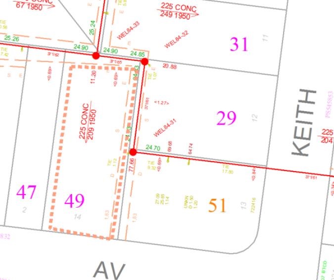
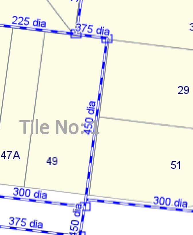
If you are building within or over an easement that is in the favour of one of the above-mentioned authorities you are required to apply to them for approval prior to commencing construction. It is important to note that consent for a build over an easement is a separate approval to a planning permit application and approval of your planning application does not mean your build over easement application will be approved. The most common type of easement affecting suburban properties is an easement of sewer and drainage shown in the image below. In this example the easement runs parallel to both the rear and side boundaries.

Within metropolitan Melbourne the rules largely prohibit the construction of any permanent or habitable structures over a sewer and water mains or within a 600mm horizontal distance of a mains connection. Eaves are typically allowed to encroach an easement by a maximum of 600mm. The local council also discourage the construction of any permanent or habitable structures over a stormwater pipe. The below diagram is from Bayside City council and outlines what they will and will not permit over an easement protecting a stormwater pipe.

The construction of permanent structures over stormwater pipes is allowed by some metropolitan councils where the dimeter of the underground stormwater pipe is equal to or less than 375mm. The City of Monash will allow the construction of a garage over a stormwater pipe that is less than 375mm diameter. This does not mean that you do not need to apply to council for consent to build over the easement, nor does it mean that council will definitely support your application but it does define some of the parameters council rely on when assessing applications.
Why can’t you build permanent or habitable structures over an easement?
The infrastructure providers want to make sure they can get access to the underground assets for repair or upgrade and don’t want to be in a position where they have to demolish a home to get access. This includes access for excavators or other heavy duty equipment. The infrastructure providers will consider and allow lightweight structures such as car ports, fences and garden sheds within easements because these types of structures can be removed easily and quickly if required without major disruption to the landowner.
Can you plant trees in easements?
You do not need approval from the infrastructure providers to plant trees within the easement. However all the providers discourage the planting of large trees within easements because over time roots will disrupt underground pipes and lead to damage or restricted water flow. In an extreme example an infrastructure provider can remove or require you to remove trees within an easement.
Can you remove an easement from your site?
You can remove an easement if you have the agreement of the infrastructure provider that has benefit of the easement or if it is a historical easement that is superfluous. An example of these types of easements can be carriageway easements that were created along the rear of inner urban properties to allow for horse and cart deliveries and pickups in the 19thcentury. Such easements are no longer used and landowners will typically fence off this section as part of their yard. The formal removal of these easements can be completed through a simple planning application and updated title plan being created by a registered land surveyor.
This article outlines the online checks about your property you can complete in order to confirm if it is large enough to be subdivided.
1. Check the zoning and planning overlay controls
Visit the Victorian government data information website and type the property address into the search bar. Click on the planning PDF icon pictured below.

This report will provide you a map of your property and show you the zone and overlay controls affecting the land. Typically your property will be in either the Residential growth zone, residential growth zone or neighbourhood residential zone. The residential growth zone is planned to accommodate the majority of growth in housing and density. The general residential zone is planned to accommodate moderate increases in density and changes to the neighbourhood character. The Neighbourhood Residential zone is expected to see very moderate increases in density or developments that depart from the established neighbourhood character.
At the top of the map there is a website link to a schedule. This is highlighted below in yellow and if you click this link it will outline if any additional building regulations beyond the standard rescode regulations apply to your site.

By clicking on the link it will open a table similar to the screenshot below. If there are no additional restrictions on your property beyond rescode then ‘none specified’ will appear in the right hand column per the image below.

If there are additional requirements for new buildings on your property beyond rescode they will appear in this column. An example below shows that for new buildings on this site the owner required a 7.6metre front setback for a new building, private open space for each dwelling of 75 square metres and also has a restriction on the front fence height allowable on their site.

It is important to check these schedule requirements for your site when researching subdivision.
2. Check where the sewer and underground assets are located on your site
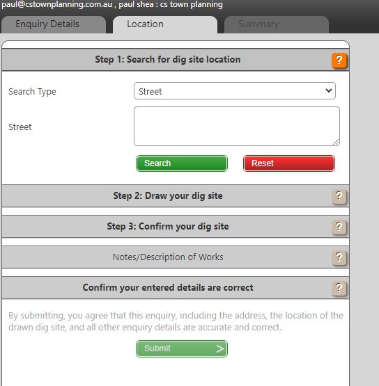
There are existing sewer, water and electricity connections on your land that maybe not be visible above ground. The location of these items is available from a service known as ‘Dial before you dig’. This is a free government service to use but will require you to create an account before you can get the information related to your site. Once you create your account and login click the ‘new enquiry’ icon pictured below.

Complete the ‘enquiry details’ table below per the image and click ‘next’.

Type your street name into the empty field below and click search.
Click on the draw tool highlighted below in yellow and draw around your property boundary. Your outline does not need to exactly match your boundary for the findings to be accurate.

Click on the green submit button on the right hand side of the screen.
In the next screen you will see a table like the below image that outlines the authorities that have been notified of your request. Each of these authorities will send you a map and letter that discloses the location of any underground assets within or close to your site.

This information is very helpful to show you how the existing house on the land connects to sewer, water and electricity. It is also very helpful to identify where any existing underground pipes are that will need to be relocated and recounted during construction. The critical information within the maps is the location of the existing stormwater pipes and sewer pipe within the property. These pipes are the property of council and the sewer provider and these authorities have very strict rules about how close you can build to these pipes and what, if anything they will allow to be built over the pipes. Very often these pipes are within a designated ‘easement’ on the land such as pictured below but they are not always.

The dial before you dig information also contains information that includes the size of the pipe and how far away from the nearest boundary it is. This information isn’t available in a section 32 or from looking at a property title and the plan of subdivision of the lot. For assistance in understanding any of the information about your property within these maps please contact our office and we would be happy to help.
3. Check the property title for covenants or restrictions
Very often property titles will include a restriction to prohibit the future subdivision of a lot. Where such a restriction exists it is easy to identify on certificate of title that comes along with a section 32.
The image below identifies where on the certificate a restriction appear.

If there is a covenant or restriction registered on the certificate of title it is important you read the restriction in full and if required contact an expert to assist in its interpretation. Any mortgages on the property will also appear in this section of title certificate however these will have no bearing on whether or not the property can be subdivided. If there is a restriction or a covenant registered on the property that prohibits subdivision on your land then it will be necessary to vary this restriction as part of the application for a planning permit to council. This adds complexity to your application as it allows any of the designated beneficiaries of the restriction the ability to prevent a subdivision being approved. If you have any restrictions registered on your title please provide a copy to our office to review prior to commencing a subdivision project.
Moreland City Council is currently conducting public exhibition for Amendment C190 which seeks to allow specifically designed single and dual occupancy residential applications to be processed via the VicSmart fast track process. The aim of the amendment is to improve the quality of two dwelling on a lot developments, by establishing a more straight forward planning assessment process for proposals which deliver good quality outcomes.
The key features of VicSmart include a 10-day permit process and applications are exempt from notice and objector appeals of Council’s decision at the Victorian Civil and Administrative Tribunal (VCAT). VicSmart was originally introduced for minor planning applications, such as construction of a front fence or swimming pool. Providing the option for ‘two dwelling on a lot developments’ and ‘a new dwelling on a lot with one existing dwelling’ applications to run via VicSmart process; with no community involvement or VCAT appeal rights and a decision from Council within 10 days, will be a very attractive prospect for many developers and investors alike but also will likely cause disputes between neighbours.
What the amendment does
The amendment introduces an additional class of application into the VicSmart provisions to construct a dwelling if there is one dwelling existing on the lot or to construct two dwellings on a lot in the Neighbourhood Residential Zone and General Residential Zone.
The provision includes requirements that the application must be compliant with Rescode standards of the planning scheme and meet other specified criteria. Two dwelling on a lot proposals which do not meet the provision’s requirements will not be eligible for the VicSmart process. The specified criteria are:
Maximum building height
The standard maximum building height requirements of the zone must be met. Within the Neighbourhood Residential Zone, the building height must not exceed 9 metres; and must contain no more than 2 storeys at any point. Within the General Residential Zone, the building height must not exceed 11 metres; and must contain no more than 3 storeys at any point.
Minimum garden area
The standard mandatory minimum garden area requirement of the zone must be met.
Landscaping
The landscaping requirements within the Neighbourhood and General Residential Zones must be met. These requirements relate to canopy tree planting.
Site layout and building massing
All numerical standards relating to street setback, site coverage, permeability and width of accessways and car spaces must be met. These requirements ensure that development respects character of the neighbourhood and makes efficient use of the site.
Amenity impacts
All numerical standards relating to side and rear setbacks, walls on boundaries, daylight to existing windows, solar access to existing north-facing habitable room windows, overshadowing of open space and overlooking must be met. These requirements ensure that the impacts of development on adjoining land owners are not unreasonable.
On-site amenity and facilities
All numerical standards relating to internal views, daylight to new windows, private open space, solar access to open space, storage and front fences must be met. These requirements ensure that high quality living environments are created for those who will live in the dwellings.
Car parking
Numerical standards relating to the number of car parking spaces must be met. In addition, requirements have been included to reduce the dominance of crossovers and car parking from the street. These requirements are consistent with Council’s case study analysis and relevant VCAT decisions and are particularly applicable to side by side dual occupancies. These requirements ensure the retention of street trees, adequate space for front garden landscaping and retention of on street car parking spaces.
Liveable (accessible) housing
All new dwellings must achieve Silver Level of performance under the Liveable Housing Australia, Liveable Housing Design Guidelines. This requirement is consistent with objectives to increase the supply of housing that is visit able and adaptable to sectors of the community with altered mobility. The specification of Silver standard performance gives greater clarity of accessibility requirements to deliver outcomes that improve upon those currently being delivered by the planning scheme provisions.
Environmental sustainability
All new dwellings must achieve a minimum Built Environment Sustainability Scorecard (BESS) score of 50%, including achieving the mandatory minimum score paths for water, energy, storm water and indoor environmental quality. This requirement will ensure that the outcomes will be of high quality and that the requirements of the Environmentally Sustainable Development local policy will be met in every application.
Why is Moreland Council proposing this?
Moreland receives more than twice the metropolitan average number of medium density planning permit applications and 40% of these applications are for two dwellings on a lot. It is a development type where compliance with ResCode standards is very high.
According to Moreland Council’s analysis, 1 in 2, two dwelling on a lot applications attracts objections, but only 1 in 10 two dwelling on a lot applications is changed as a result of giving notice. Any changes made are almost always very minor in nature and typically involve a ruler length in difference in some aspect of the building envelope. This is a very low return on the investment of time and energy put into objections and VCAT appeals by neighbours. Moreland Council believes the amendment will provide better outcomes, for both those who live in this housing, and the broader Moreland community, whilst at the same time making more effective use of resources.
What about VCAT Appeals?
VCAT is concluding that Council’s assessment of two dwelling on a lot applications against the requirements of the planning scheme is robust and reasonable. Third party rights of review are adding to the time taken to obtain a decision but not altering the outcome in any meaningful way.
To qualify to be processed within the streamlined process, all requirements must be complied with. By requiring development to adhere to all standards, it will be of high quality. If any of the requirements are sought to be varied, the application will be processed within the standard planning application process with public notice and VCAT review rights applicable.
Benefits of the more straight forward assessment process
Moreland Council suggests two dwelling on a lot development that complies with all numerical standards of the planning scheme achieves high quality outcomes for both those who live in this housing, and the broader Moreland community. The benefits of the straight forward assessment process are:
- Better quality housing for the Moreland community
- Improved customer service and certainty for landowners, developers and the community
- ResCode standards become mandatory rather than discretionary for those opting for this application pathway
- Better ESD outcomes due to the inclusion of ESD as a requirement in criteria
- Better housing accessibility due to a requirement for certification from Liveable Housing Australia.
By requiring full compliance with requirements to qualify for this application stream, Council can secure these outcomes for the community without the time and expense for all parties associated with seeking improved compliance via objections or expensive VCAT reviews.
Where to inspect Amendment C190 documents
The amendment can also be inspected on the Department of Environment, Land, Water and Planning website.
Have your say
Amendment C190 is now on public exhibition and you are welcome to make a written submission to Council to express your views. Submissions must be received by Friday 17 July 2020.
If you would like to make a submission to council, our expert town planners can assist you to make a formal written submission. Feel free to contact our team to discuss.
As COVID 19 restrictions ease, the Victorian Civil and Administrative Tribunal (VCAT) has recently announced new measures leading to partial reopening of the tribunal. With VCAT putting in place a digital system to allow hearings to be heard via online platforms, phones and “On the Paper”, some less complex cases were able to conduct hearings with other matters adjourned. According to VCAT data, there have been up to 12 per cent of cases were able to be determined on the paper without a formal face-to-face hearing during the shutdown.
To date, cases that were adjourned between March and May are in the process of being relisted for hearing in the last quarter of this year and cases listed for hearing between 18 May to the 29 May 2020 have been adjourned until October this year. Majority of the cases will be determined “on the paper” with a small number of compulsory conferences occurring in this period over the telephone or via video conferencing.
If the participants opt for a traditional face-to-face hearing the matter will be adjourned until 2021 due to the backlog of existing cases and the need to consider social distancing criteria.
VCAT also noted that new applications would not have been receiving initiating orders from VCAT because resources have not been available to facilitate this as VCAT is working on this backlog and all applications that have been filed will soon be receiving initiating orders.
To deal with the backlog of cases, the Planning and Environment Division launched the revamped Short Cases List which has been set up to deal quickly and efficiently with certain cases in the Division.
Applications in the Short Cases List will be those that are suitable for hearing and determination within an allocated time of three hours. Two hours will be allocated for the presentation of submissions and evidence. A further one hour will be available to allow members to prepare and deliver a decision.
The main features of the revamped list include cases that:
- have limited parties
- have issues which are limited in number and extent and where a site inspection is unlikely to be required
- are capable of being heard and determined within an allocated time of three hours
- have addressed any Cultural Heritage Management Plan issues.
- Hearings to be listed at approximately 12 weeks from lodgement of the application.
Parties will be required to give VCAT and each other their submissions ahead of the hearing. Parties are encouraged to use a template for the preparation of submissions, which identifies the issues in dispute.
VCAT also announced that all objector appeals will be listed for compulsory conferences which will be conducted by telephone, online platform or “on the paper” as appropriate.
For all applications received in the Major Cases List, these applications will no longer be automatically listed for a practice day hearing. If an applicant requests a practice day hearing, justification for it will need to be provided. If procedural orders are sought, those orders should be included within the application for review.
The process of VCAT hearings are changing rapidly and these initiatives are assisting to reduce the lengthy process. These new methods of hearings are likely to become the new normal and in turn allowing more cases to be heard in a shorter timeframe.
During the past three months of lock down, CS Town Planning successfully represented a number of clients in VCAT and achieved satisfactory results via the “on the paper” method. If you have any queries in relation to the changes to the VCAT hearing process, please contact our office to see how we can assist. For the full announcement by VCAT, please click here.
A Planning Scheme Amendment (C186dare) with the aim to increase Open Space Levy, similar to Monash City Council’s C148 Amendment, been proposed by the Darebin Council. The council is proposing to increase the open space levy to ensure Darebin improve the existing open spaces and increase open space within Darebin.
It is understood that Darebin Council engaged the same planning and economic consultancy firm as City of Monash, SGS Economics & Planning, to analyse Darebin’s open space contribution requirements. According to the report, The Open Space Contributions Review Report (SGS Economics and Planning, 2019), with no increase in contribution rates from developers, there will be a per-capita reduction in the amount and quality of open space available to the Darebin community.
The Darebin Planning Scheme currently collects an open space contribution rate as follows:
| Type or location of subdivision | Amount of contribution for public open space |
| The subdivision of land that creates: | |
| 1 additional lot | None specified |
| 2 additional lots | 2% |
| 3 additional lots | 3% |
| 4 additional lots | 4% |
| 5 or more additional lots | 5% |
The report finds that there is need for an 18.2% open space contributions rate across land uses in Darebin to reach optimum quality of open space (30 square metres per capita). However, the report recommends an increase in the levy to a 10% open space contributions rate in Darebin across all land uses, to help ensure that the future community will have access to a reasonable standard of public open space provision. A 10% open space contributions rate equates to approximately 16 square metres (or equivalent) of open space provision per capita. Similar calculation and reasonings as the report prepared for City of Monash which Monash’s C148 Amendment was based on.
The proposed new open space levy required is calculated based on the following factors:
- Open space need per person
- Projected population grown
- Net developable land
The amendment proposed by Darebin Council is pursuing a flat rate levy that applies to all subdivisions of two or more additional lots, as every development, regardless of its location or size, has the same proportional responsibility to contribute towards the open space needs of the future population. The increase in the Open Space Levy rate to 10 per cent will apply to all subdivisions for residential, industrial or commercial purposes within the municipality (exemptions continue to apply).

The full Planning Scheme Amendment documents released by Darebin Council can be found here.
The Independent Panel Hearing for Monash City Council’s C148 Amendment took place in February 2020 and the Interim Panel Report was released recently. Monash’s amendment was widely opposed by the public with 36 submissions opposing the amendment out of the 44 submissions received. The Panel took the view that a municipal wide benchmark of 30 square metres was something of an unrealistic target in a built-up area like Monash. In the case of City of Darebin, it is expected same view will apply as it is also a built-up area.
In the Interim Panel Report for Monash’s C148 Amendment, the Panel concluded:
- There is a lack of an implementation plan which nominates areas in which land acquisition will be sought, in addition to open space projects and works with cost estimates.
- The exclusion of regional open space and open space outside the municipality overstates the areas within the municipality that are not within 400 metres of open space.
- Whether a change in the rate is justified depends on the basis for calculating the new rate.
- The treatment of the whole municipality as a single planning unit is appropriate.
- An inclusionary requirements approach is reasonable.
- Applying the same rate to employment land is not justified.
- Council’s standard of 30 metres square per person does not adequately support the calculation of a 10 per cent contribution rate.
- An implementation plan which nominates precincts in which land acquisition will be sought and projects and works in open spaces with cost estimates is a more appropriate basis for the calculation of a contribution rate
Based on the reasons set out in the Interim Report, the Panel recommends that Monash Planning Scheme Amendment C148 not proceed at this time and recommends the Monash Council to review the Amendment documents and undertake additional work before re-exhibited to the public. The Panel will then reconvene to consider any submissions. Alternatively, Council should abandon the Amendment proposed by Monash. More on Monash C148 Amendment: here
Darebin Council’s proposed Planning Scheme Amendment C186dare was on exhibition from 14 November 2019 to 16 December 2019 with Panel Hearings originally planned to take place in early 2020 but due to the impacts of the Covid-19 pandemic and the associated social distancing laws, Planning Panels Victoria (PPV) have been unable to hold face to face planning panel hearings. A directions hearing was held via teleconference on 16 April 2020 to consider the way that the planning panel should be heard with a further directions hearing has been scheduled for 29 May 2020. More updates by the council will be posted here.
The Amendment C148, proposed by City of Monash, proposes to increase the public open space contribution requirement for subdivisions of 3 lots or more to 10% cash, 10% land, or a mix of both. More on Amendment C148 can be found here. Currently Council requires a public open space contribution of between 2% and 5% depending on the number of lots created. A contribution rate of 10% has been determined as necessary by the City of Monash to deliver a reasonable standard of open space provision across the whole of Monash for a growing population. The Monash Council claims this contribution rate reflects the need to ensure that all residents in the future have contributed to providing an appropriate level of public open space services and earmarks a need of 30 square metres per person, according to a report prepared by Dr Marcus Spiller.
On Monday 17th Feb 2020, an independent Planning Panel took place for the hearing of the Amendment C148. Dr Spiller, who supports the council’s amendment provided justification on why Council should adopt a rate of 30 square metres of Open Space per person which in turn, translates to requirement of 620.72 hectares of Open Space in City of Monash by 2028. Ultimately arriving at the uniform 10% contribution rate for Monash. You can download the Evidence statement prepared by Dr Marcus Spiller here. Matt Ainsaar, Managing Director and founder of Urban Enterprise, representing Salta Properties, Golf Road Project Development and Talbot Road Finance objected to the amendment, identified three main issues with the Amendment relevant to open space contributions:
- The appropriateness of the open space calculation method applied to determine the 30 square metres per person;
- The suitability of the provision standard of 30sqm per person; and
- The equity of applying a single rate to all land uses and areas within the municipality.
An Interim Panel Report has recently been released by Planning Panels Victoria on 5 May 2020.
From the report, it is clear the amendment was widely opposed by the public with 36 submissions opposing the amendment out of the 44 submissions received.
In the report, the Panel takes the view that a municipal wide benchmark of 30 square metres was something of an unrealistic target in a built-up area like Monash. The opportunity to acquire additional open space is severely constrained, a view supported by the evidence presented to the Panel.
In addition, as population increases the ratio per person will, of necessity, decrease and so a per person provision has only limited value. The Panel concluded that it was a flawed metric for the calculation of an appropriate open space levy rate. In fact, the MOSS, which was prepared by Dr Spiller to support the amendment, said as much when it stated:
However, the 30m² per capita benchmark will not be considered as a blanket figure for determining open space as there are other factors that need to be considered, such as ‘proximity-based’ standards.
The absence of an implementation plan as part of the MOSS was deemed a significant shortcoming in arriving at an appropriate open space levy rate by the Panel. Although, the Panel accepts that, with a growing population there may be a need to increase the amount of the open space levy. However, the amount of the increase in the open space levy and the increase in its scope was not justified by the information presented.
The Panel listed out matters that need to be addressed:
- An implementation plan should be developed. More detail on each of the implementation tasks, responsibilities, cost estimates and priorities need to be included.
- More analysis and justification are needed to apply the same open space levy rate to residential and non-residential subdivisions.
- There is a lack of clarity and consistency in the use and meaning of community open space.
- The identification of public open space gaps in Monash should be clarified. The Panel considers that the use of ‘Monash community open space’ as the primary measurable is too narrow and does not take into account open space in adjacent municipalities or regional open space.
In the Interim Panel Report, the Panel concluded:
- There is a lack of an implementation plan which nominates areas in which land acquisition will be sought, in addition to open space projects and works with cost estimates.
- The exclusion of regional open space and open space outside the municipality overstates the areas within the municipality that are not within 400 metres of open space.
- Council’s expenditure on open space is not a relevant consideration for the Panel.
- Whether a change in the rate is justified depends on the basis for calculating the new rate.
- The treatment of the whole municipality as a single planning unit is appropriate.
- An inclusionary requirements approach is reasonable.
- Applying the same rate to employment land is not justified.
- Council’s standard of 30 metres square per person does not adequately support the calculation of a 10 per cent contribution rate.
- An implementation plan which nominates precincts in which land acquisition will be sought and projects and works in open spaces with cost estimates is a more appropriate basis for the calculation of a contribution rate
Based on the reasons set out in the Interim Report, the Panel recommends that Monash Planning Scheme Amendment C148 not proceed at this time and recommends the Monash Council to review the Amendment documents and undertake the following additional work:
- Develop an implementation plan either as part of the Monash Open Space Strategy or as a separate document, which nominates precincts in which land acquisition will be sought and projects and works in open spaces with cost estimates.
- Use the implementation plan as the basis for the calculation of an open space levy rate in place of the 30 square metre macro-provisioning standard.
- Develop a detailed justification for the application of the same open space levy rate to residential and non-residential subdivisions.
- Clarify the use and meaning of community open space in the Monash Open Space Strategy and Clause 22.15.
- Review the areas designated as public open space gaps.
The Panel recommends once these works are complete, the Amendment should be re-exhibited to the public. The Panel will then reconvene to consider any submissions. Alternatively, Council should abandon the Amendment. At this point in time, Monash Council is currently considering the Panel recommendations to determine the next steps.
The full Interim Panel Report can be downloaded here
Melbourne City Council and the Department of Environment, Land, Water & Planning (DELWP) have been taking each other to court since 2014 surrounding a permit for a hotel development at Melbourne’s Forum Theatre and its neighbouring land. The key issue concerned was the floor area of the proposed project. Under the Melbourne Planning Scheme, the Minister of Planning is the responsible authority for considering and determining applications for developments with a gross floor area exceeding 25,000 square metres. If the floor area does not exceed 25,000 square metres, the council normally assess the application and issue the planning permit.
In the permit application at the Melbourne Forum site, the permit applicant had combined the floor area of the Forum Theatre (6,387 square metres) with the gross floor area of the development scheme for the neighbouring site (19,620 square metres). Melbourne City Council successfully argued that the Minister’s decision to grant the permit was invalid because the floor areas could not be combined in such a way. Initially, The Victorian Civil and Administrative Tribunal (VCAT) held that the hotel development was not physically or functionally connected to the Forum Theatre building. Accordingly, Melbourne City Council was the responsible authority, not the Minister.

However, with The Minister of Planning taking the case to Supreme Court of Victoria, the key issue no longer surrounds the permit for the development at Forum Theatre but Melbourne City Council’s & the state planning departments different interpretation of the Schedule to Clause 72.01 (Responsible Authority for this Planning Scheme) of the Melbourne Planning Scheme. Although the case is still not yet settled, this issue surrounding the interpretation has been evolving over the past six or so months, led by the Victorian Supreme Court’s decision in relation to the Forum Theatre’s permit application.
Previously, the general public’s understanding is that only applications for new developments that exceeds Gross Floor Area of 25,000 sq.m will be considered and determined by the Minister of Planning. However, it has been determined that, other than VicSmart & Subdivision applications, any use or development application that engages a building with a Gross Floor Area greater than 25,000sq.m sits with the Minister for Planning, based on Melbourne City Council’s current interpretation of the provision.
The lack of consistency in how this provision was being interpreted across Melbourne City Council and the State government planning department (and across application types) have caused confusion to those who are looking to apply for planning permits within City of Melbourne. It is important that permit applications are lodged to the correct responsible authority to ensure the statutory authorisations issued by Council or the Minister for Planning are valid and lawful.
The team at CS Town Planning have put together the below to explain the process on how to make applications to the Department of Environment, Land, Water and Planning:
The Best Starting Point: Speak to a Town Planner
A town planner with experience in dealing with Department of Environment, Land, Water and Planning can provide you with advise on what types of applications are assessed by the department. View the full list of applications and decisions on planning permits where the Minister for Planning is responsible for making the decision at this link.
Preparing for the application
The Department of Environment, Land, Water and Planning (DELWP) do not offer pre-application meetings so it’s important to have professional assistance in the early stages. A professional town planner will be able to confirm and check the requirements before you submit an application to the department. You’ll need to provide different information for different types of permit applications. That might include site plans, elevation drawings or a written report. This information will need to be at professional town planning standard for council to conduct assessments on. A professional town planner will be able to justify your project in a way that the department will be more likely to support your idea, leading to a more seamless approval process. Having a town planner to assist you earlier on, can identify all the requirements right from the start and help you to prepare what is required for you to get your dream design approved.
Below outlines the different stages your town planning application will go through after it has been lodged to DELWP.
Request for Further Information
After your town planner lodges the application, a planning officer of DELWP will be assigned to assess the application and may advise you (in writing) further information is required. This stage is called Request for Further Information stage, this request is common and 99% of applications will go through this stage. If they do, they will contact your town planner who will then be able to work with you and your other consultants to gather all the required information and provide them promptly to the council. If the information can’t be provided in time, the application won’t be processed further.
Referral Authority
The Minister for Planning will generally seek comments from the local council of the subject property when assessing a planning applications. In specific circumstances, Councils are a Referral Authority for the application, and the Minister for Planning must formally refer the planning application to Council.
Officer’s Report
Once all information required has been lodged and Referral Authorities provided comments, a report will be prepared by the assigned officer. The report assesses the proposal against the relevant planning controls and policies, and contains technical advice used to inform the Minister’s decision.
Minister’s decision
The Minister of Planning will assess the proposal and decide to:
- Grant a permit
- Refuse a permit.
A permit can be granted with or without conditions, and a proposal can only go ahead if all conditions are met. For example, a permit for a restaurant might be issued on the condition that a certain number of car-parking spaces are provided. There are opportunities to apply to VCAT for a review such as if a permit condition is unacceptable, similar to normal council applications.