

Monash Council are seeking to introduce a new public open space contribution rate of 10 percent which will be implemented across the whole of the municipality for subdivisions. If implemented the amendment will see people paying up to 400% more to Monash council in contribution rates subdividing lots into three or more. Currently if you own a site in Monash worth $2,000,000 and successfully subdivide it into three lots you are required to pay 2% of the value of the land ($40,000) directly to council for future public open space. Under the amendment proposal you will be required to pay $200,000 to council as the contribution for private open space. That is a 400% increase.
The Amendment:
•Amends the Schedule to Clause 53.01 to require that all subdivision provides a public open space contribution at a rate of 10%.
•Introduces a new Local Planning Policy – Clause 22.15: Public Open Space Contributions Policy that sets out the guidance for the process on when, where and how a public open space contribution will be required, including whether in the form of cash in lieu, land or a combination of both.
•Replaces Clause 21.10 in the Municipal Strategic Statement with a new Clause 21.10.
Monash has followed in the footsteps of Frankston City Council who earlier this year proposed to increase their public open space contribution rates. However Monash have taken a much more heavy handed approach increasing their rates to one of the highest of any council.
Frankston set its rates between 2% and 8% with the highest rate of 8% only payable for subdivisions within the Frankston Metropolitan Activity Centre which has a higher population density and higher land value than in other areas of Frankston. Currently contribution rates in Monash are between 2% and 5% depending on the number of lots created but the new amendment does not take into account the number of lots or the location of the subdivision instead it is a blanket 10% rate for all subdivision in Monash. Under the new amendment those doing a 3 lot subdivision will pay the same 10% contribution rate as a person doing a 20 lot subdivision.
Below is the current public open space contributions rates in Monash
Number of lots Amount of contribution for public open space
3 lots 2%
4 lots 3%
5 lots 4%
6 or more lots 5%
What are public open space contributions?
When land is subdivided into 3 or more lots it is a requirement that a developer pay a contribution of the site value to the council. This is then used to create open spaces such as public parks, playgrounds and reserves. The contribution is either a percentage of the site value, a land contribution or a combination of the two.
Why the increase in contribution rates?
The new rates will see a major increase in revenue for the council which will provide funding for public open space project. Monash reports that by 2028 there will be an increase of 14,057 people to the Monash population increasing demand for public open space areas within the municipality.
Monash have deemed the increase as ‘necessary to deliver a reasonable standard of open space provision across the whole of Monash for a growing population’.
They said: “This contribution rate reflects the need to ensure that all residents in the future have contributed to providing an appropriate level of public open space services and recognises a need of 30 square metres per person.”
What does this mean for developers?
This amendment will have a serious effect on property developers hitting small developers particularly hard. Currently a 3 lot subdivision only attracts a rate of 2% which will be increased to five times that amount under the new amendment. Larger developers may be able to absorb the extra cost and still make a profit whereas this will not be the case for everyone. In the short term it will see developers fast forward their projects to avoid paying the new rates. But in the longer term it may see smaller scale developments being stifled. Two lot subdivisions will remain exempt from making any public open space contributions.
Are you affected by the new contribution rates?
Amendment C148 commenced public exhibition on Monday 17 June and will end on Monday 15 April 2019. People will have until then to make submissions to the council for consideration. Any person who may be affected can make a submission to the planning authority about the amendment. Please contact us if you will be affected by the amendment and we can prepare a professional submission on your behalf to Monash council via post or email. Your name and contact details are required for council to consider your submission, and to notify you of the opportunity to attend Council meetings and any public hearings held to consider submissions.
An independent planning panel will consider the Amendment and each submission that Monash Council receives. The week of 23 September 2019 and the week of 21 October are the dates currently proposed for the panel hearings.
More information about the amendment, including the amendment documents are available on the City of Monash website.
Developers will no longer be able to avoid paying stamp duty by entering into an agreement to develop a site without purchasing the land from the landowner.
Developers are now treated as having beneficial ownership of any site worth more than $1 million and will be subject to paying 5.5% stamp duty on potentially the entire value of the land.
These new provisions under the State Taxation Acts Amendment Act 201 brought in by the Victorian Government came into effect on 19th July.
Is has been introduced to help off-set the projected $5.1 billion shortfall in stamp duty expectations following the decline in Victorian property values from their 2017 peak.
Previously stamp duty was generally not payable by developers if there economic entitlement was less than 50% of the development. This threshold has now been removed and developers will be liable to pay stamp duty on any economic entitlement regardless of the percentage.
What is economic entitlement?
A person who enters into an agreement in which they are entitled directly or indirectly to obtained an economic benefit from the land.
A person acquires an economic entitlement if the person is entitled to any one or more of these:
• To participate in the income, rents or profits derived from the land.
• To participate in the capital growth of the land.
• To participate in the proceeds of sale of the land.
• To receive any amount determined by reference to any of the above matters.
• To acquire any entitlement described above.
When do developers have to pay stamp duty?
The stamp duty is payable when the economic entitlement has been acquired as the person has obtained an ‘ownership interest’ in the land which is then liable for stamp duty.
It is payable upfront when the economic entitlement is agreed upon not when the developer receives the entitlement. It is calculated by the percent interest the developer has obtained based on the market value of the land at the time of the agreement. It is not determined by the end value of the development.
The economic entitlement is treated as obtaining a beneficial interest in the land. The amount of stamp duty payable is dependent on the percentage of the beneficial interest acquired by the developer. Therefore if the land is valued at $10 million and the developer has acquired an economic entitlement of 10 percent they then will have to pay stamp duty of $55,000 (5.5 percent of their 10 percent interest)
The beneficial interest will be equal to:
The percentage of the economic entitlement that is acquired; or
100% if:
- the percentage of the economic entitlement is not specified or cannot be determined;
- there is a percentage specified, but the person or their associate is entitled to other amounts; or
- two or more economic entitlements of different types are acquired.
Developers will need to make sure that a clear percentage of interest is identified in any arrangement with land owners to avoid being treated as having a beneficial interest of 100 percent and being charge 5.5% stamp duty on the whole of the land value. However in these cases developers can apply to the Commissioner of State Revenue who can lower the percentage if they see fit.
What does this mean for developers and the Victorian housing market?
The changes will have major implications for developers who may now start to rethink develop agreements with land owners and be put off from certain development projects all together.
Development Company Resi Ventures have warned that the changes will reduce supply and increase land prices for buyers.
Already they have said they will walk away from a 900-lot house and land project in Melbourne West following the changes.
“Imposing a tax upfront is a draconian measure, stamp duty is not normally paid until settlement so this accelerated taxing treatment will torpedo a number of deals Resi Ventures has in the pipeline,” Resi Ventures director Mr Anthony Braunthal said.
Mr Braunthal believes that the Victorian Government will not receive the ‘tax windfall it expects’ and may even see revenue fall.
“Developers are the very organisations that create jobs and pay significant amounts of tax. More should be done to drive affordability down by reducing regulation and taxation – not increasing imposts on development,” he said.
Franchise gyms such as ‘Anytime Fitness’ ‘F45’ and ‘9 Round Fitness’ are becoming commonplace in suburbs throughout Victoria. These traditional and classed based fitness centres require planning permits from local councils prior to opening. We have secured planning approval for a vast array of gym types around Melbourne and Victoria including popular gym franchises, ‘Anytime Fitness’ and classed based concepts such as ‘F45’ and ‘9 Round fitness’. Here are some useful tips if you are opening a gym along with what you will need as part of the planning permit process.
Don’t pay more than you have to
Planning approval can take months to be obtained and you don’t want to be paying out for a lease months before the gym is operating. Apply for your planning permit before you begin paying rent or make sure to insert a clause that makes the lease subject to a permit being approved by council. Very often landlords are open to such terms and will offer you the time required to secure a planning permit before you begin paying rent. Make sure to negotiate a good rent free period of at least three months to allow you to obtain the planning permit.
Talk to your neighbours before lodging an application
If you have apartments or residential houses next to your premises it is very important to approach them directly to introduce yourself as the business owner and to ask them if they have any concerns with you opening a gym next to them. If you encounter a lot of objections from nearby existing neighbours to things like early class times or loud music then this will make it more difficult to obtain council approval. There is far less public opposition to gyms in existing commercial or industrial areas where there is no existing residential houses or apartments close by. Properties in these locations often receive a planning permit with a lot more ease and within three months of applying to council.
What you will need for your gym planning application
- Development Plans
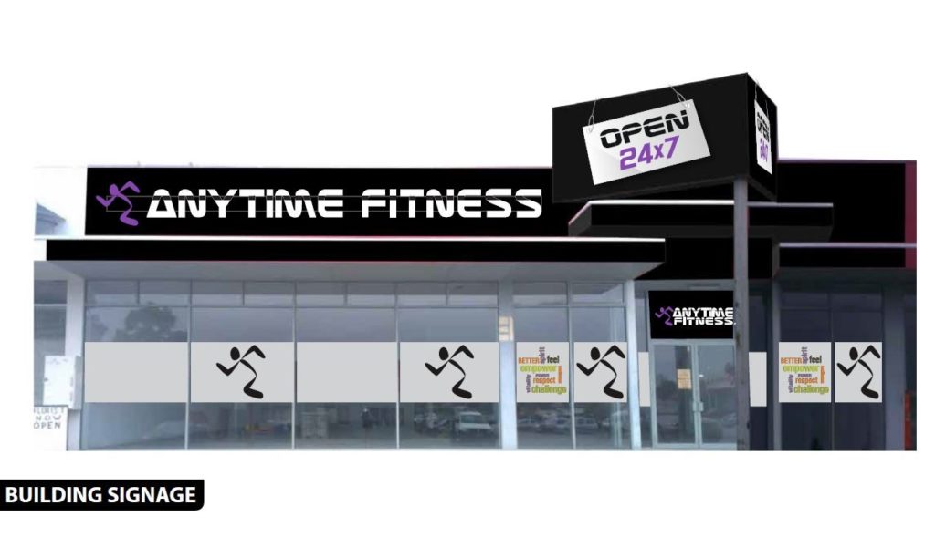
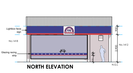
You will need floor plans showing the internal layout of the gym along with ‘proofs’ of any signs that will be displayed on the building to advertise the gym. An example of such ‘proofs’ is shown below.

A 9 round fitness gym in Melbourne CBD. We have obtained approval from many gym franchises in Melbourne helping gym owners open their businesses in the ever expanding market.
- Town Planning Report.
We complete a town planning report that outlines the proposal and how it complies with the relevant planning scheme. This is a mandatory requirement of the application and includes information about proposed class times, number of staff on site and opening times.
- Acoustics report.
An acoustics report may be required as part of the planning application and is done by a qualified acoustics consultant. This report will be a requirement if you have neighbouring residential properties. If your premises is not close to any residential or other sensitive land use then this report will not be required. The report measures the amount of noise that will be caused by the operation of the gym. It will outline how noise will impact the amenity of neighbouring tenancies and the surrounding area and how it will be controlled. As part of this report the acoustics engineer may require you to install noise absorption measures such as rubber flooring or double glazing. This will be particularly relevant for 24 hours gyms or gyms with music and early morning classes which may cause noise disturbance.
- Traffic report
Similarly a traffic report will likely be needed to assess the effect of an increase in traffic from people attending the gym and how this will be managed. A traffic report is likely to be required if you have no off street car parks allocated for patrons of the gym. This is very common for gyms and Council frequently approve planning permits for gyms with no car parks on site. This report is required to demonstrate to council that the absence of car parking will not create a local traffic issue.
The planning permit process once the application is lodged
Once the above items have been prepared your planning permit application can be lodged to the local council. On average it takes councils 3 – 4 months to process a planning application and issue a permit. Below is a outline of the steps that occur after lodgement:
- A letter will be sent from council informing us that the application has been accepted and allocated to a council town planner to assess. The town planner will be the point of contact at council and will oversee the application from start to finish, ultimately deciding whether to approve it.
- Within 28 days of the application being accepted council may request further information. This is requested in approximately 90 percent of all planning applications. The information request can range from amending parts of the plans to providing additional information to help decide the application. A deadline will be set for when the information has to be provided and is usually around two months.
- Once the further information has been received by council the application goes to public advertising. A sign is erected on the site advertising the application to the public for a period of 14 days. Council also send letters to neighbours and property owners that will be affected by the application to notify them of the application and give them the opportunity to comment. These comments typically come in the form of objections.
- If there are several objections to the application a consult meeting will be held. This is where both the applicant and objectors make submissions to the council. A consult meeting may lead to reduced hours of operation or reduced class times to gain council support.
- If there have been objections to the application then a notice of decision (NOD) to grant a permit will be issued. This gives objectors 28 days to appeal the approval at VCAT if they wish. Once the 28 days have lapsed and no VCAT appeal has been made the permit will be issued.
- If there have been no objections to the application a permit will be issued with conditions attached to it. Once these conditions have been met the council will endorse the floor plans and ‘proofs’ of any signs. This makes up your full planning approval and you are ready to move on to obtaining your building permit.
Remember the entire process can take 3 months so allow for this when negotiating your lease. If you have a lot of public opposition to your application from neighbours the process will take longer.
If you are opening a gym and want to ensure approval with the help of professional town planners then contact us on 03 98241902 and we would be happy to discuss your project.
The Coalition Government has promised to make housing more affordable by lowering deposits for first time buyers. Housing affordability is an ongoing issue in Australia particularly for younger people trying to get a foot on the property ladder. To help remedy this the Collation Government announced a First Home Loan Deposit Scheme. Under the new scheme eligible first time buyers will only need a 5% deposit for a mortgage rather than the usual 20% with the government making up the shortfall. But what will this slash to mortgage deposits actually mean for first time home buyers and how will this affect the housing market?
The government has committed 500 million to the fund the scheme and it will it be administered by the National Housing Finance and Investment Corporation starting from January 1st.
Along with decreasing deposits, the scheme will also exclude people from paying costly lenders mortgage insurance. This is normally required by lenders on deposits under 20%. It protects them if home owners can’t afford to meet their repayments and can cost around $10,000 or more.
Who is eligible?
The loan is available to single first time buyers earning up to $125,000 a year or couples earning up to $200,000 a year.
The government have said that the new loan will be capped at 10,000 people a year and will be on a first come first serve basis. This is a small percentage of first time buyers considering more than 110,000 Australians bought their first home in 2018.
However this seeming fix to home ownership and affordability may actually leave first time home owners paying more in the long term.
Research by Ratecity found that currently a $500,000 mortgage with a 20% deposit would mean monthly repayments of $1,982 a month over 30 years. Whereas a 5% deposit would see monthly repayments increase to $2353 a month over 30 years and paying an extra $58,774 overall.
The research did find that the scheme would sustainably decrease the amount of time it would take for people to save for a deposit. Based on average house prices would-be home owners in Melbourne who save $400 a week would be able to afford the 5% deposit over 4 years earlier than saving for the 20% deposit.
However RateCity research director Sally Tindall warned first time buyers to be cautious as they will be ‘signing up to a 30-year mortgage with a wafer-thin deposit.’
She said that starting with such a small deposit will see people making higher monthly repayments and shelling out thousands more in interest to the bank over the life of the loan.
“Don’t rely on the government to tell how much you can borrow. Do the maths yourself, taking into account things like extra interest versus not having to pay rent or lenders mortgage insurance, and work out whether a 5% deposit is a good idea for your financial future. You may find you’re worse off in the long run,” she said.
What will this do to house prices?
Housing prices have been steeply falling in Australia and this scheme could see a turnaround for the housing market with more demand driving up house prices. Prime Minister Scott Morrison said that the policy would have a “firming” effect on falling house prices.
However Brendan Coates and John Daley of Grattan Institute warned in an online article forThe Conversation that the scheme will have little effect on increasing home ownership for the masses. The 10,000 person a year cap is around one in every ten mortgage loans which they estimate would make home ownership ‘only 1 per cent higher in a decade’s time.’
They also warned that it will be counterproductive to housing affordably if the 10,000 person cap is lifted, which has been suggested by the Coalition Government.
“If it “succeeded” in rapidly expanding demand from first home buyers, it would push up prices for everyone, not least all the other first home buyers trying to get into the market,” said Brendan.
Whether good or bad in the long term the news will be welcome to property developers who rely on first home buyers to purchase their new development.
A new Planning and Environment leader will be appointed at VCAT following the planned retirement of the current leader. Senior Member Teresa Biscussi will lead the tribunal’s Planning and Environment list from July 1st 2019 after being appointed by VCAT President Justice Quigle.
Teresa Biscussi will take over the role from Deputy President Helen Gibson who is retiring at the end of June this year. Teresa joined VCAT as a Senior Member in 2018 previously working as a Principal for a legal firm in Melbourne. Her legal career has focused on planning law and encompassed regular appearances at VCAT, Planning Panels Victoria, Heritage Council, Magistrates’ Court, and the Victorian Commission for Gaming and Liquor Regulation.
VCAT described Teresa as an ‘experienced and highly skilled professional with a longstanding commitment to community service’ and that her ‘wide experience will stand her in good stead in this important role.’
VCAT thanked Deputy President Helen Gibson for her time as leader and said: “We celebrate the enormous contribution of Deputy President Gibson, who has led the Planning and Environment List from 2004 to present.”
Before becoming the leader of Planning and Environment Helen Gibson was the inaugural Chief Panel Member of Planning Panels Victoria from 1996 up until 2014 when she took the leadership role at VCAT. She participated on many planning reviews and advisory committees, including as an Expert Group Member on the Review of the State Planning Policy Framework from 2008 to 2010. In 2016, Helen was named a Member of the Order of Australia for significant service to planning and environment law in Victoria, and as a role model for women in the profession.
VCAT lists, cases & planning permit decisions
VCAT is made of a President, Vice Presidents, Deputy Vice Presidents, Senior Members and Members. VCAT members are appointed to oversee VCAT listings and hear and decide cases. VCAT has different lists each dealing with cases of a similar nature. All Planning and Environment list members have expert planning knowledge and usually come from planning backgrounds. Planning appeals are heard by a VCAT member who will decide the case after hearing from both parties.
A full list of VCAT member can be found here.
Stonnington council have introduced a new process where developers must enter a deed of protection and provide a bank guarantee to secure the protection of significant trees and vegetation as part of their planning approval. The bank guarantee will apply to trees on the development site, neighbouring sites and nature strip that have the potential to be impacted by buildings and works.
Much like a security deposit the bank guarantee must be paid upfront by the permit holder once the planning permit has been granted. It will be a mandatory requirement as a condition of any planning permit where trees and vegetation are to be retained. The bank guarantee must be put in place before endorsed plans will be issued. The amount forfeited, and the conditions upon which the amount would be forfeited will be outlined in the deed. The council have informed current applicants that the amount of the bank guarantee required ‘is based on an arboricultural formula, which considers factors such as the size, health and structure of a particular tree’. They have not released any details on how much applicants can expect this to cost per tree or how close a proposed retained tree has to be to a proposed building to be considered subject to the protection deed and bank guarantee.
According to Stonnington this new measure will tackle the ‘serious and frustrating issue’ of significant trees being removed or damaged after a permit has been issued. The council have said that it is difficult to ‘reactively address’ this issue and that there are ‘too many instances where permit holders are not adequately protecting vegetation that is to be retained as part of a development approval.” The council hope that these guarantees will achieve “greater pre-emptive protection of vegetation in the future.’
Due to the high level of redevelopment there has been a loss of trees across the municipality. The increasing population, housing growth and competition for limited space have all led to the removal of urban trees and vegetation in the area. Therefore the council are now implementing these new measures.
They have said that developers must have high regard for protecting and retaining trees as wells as planting new vegetation as it is ‘often a critical determining factor to the issue of a planning permit’ The new controls seek to implement the Council’s Urban Forest Strategy which was adopted in June 2017.
How much will it cost as part of the planning permit approval?
The cost will be assessed on an application by application basis and will be calculated using the Burnley method. This method is a mathematical equation that establishes the dollar amount a tree is worth. It is calculated by multiplying the size of the tree, which is based on the height and canopy spread, by its retail price. It is also multiplied by four different modifiers which all have a specific value. These include tree size, useful life expectancy, form and vigour and location of the tree. For example large trees with a long life expectancy will cost more than smaller trees that are in poor health. The modifiers are used to minimise inconsistences in price depending on who values the tree. The cost will then be stated as part of the condition attached to the planning permit. The applicant must meet all costs associated with drafting and execution of the Deed, including those incurred by the council.
When there are ‘significant trees’ which may be affected by a new development an arborist will be appointed to assess them and establish a tree protection zone. This protection zone is a certain area around a tree that should not be encroached upon in order to protect the tree. In general councils allow developments to encroach on only 10 percent of the tree protection zone. If the development encroaches more than 10 percent then it is up to the applicant to establish how this tree will be protected.
When will the cost be returned?
Once a period of 12 months has lapsed following the completion of all works at the site the council can release the bank guarantee upon the written request of the developer. The council will first inspect the tree(s) and confirm they have not been detrimentally affected from the build. The deed puts the onus on the permit holder to notify council when the development has been completed and the 12 months has begun. A developer must write to council notifying them that a Certificate of Occupancy has been issued and that the 12 months can commence. A Certificate of Occupancy is issued by a building surveyor to confirm that the completed building work is suitable for occupation. This is a very long time for developers to wait before the guarantee is return and could see the money left with the bank for several years until the development is completed. However this seems to be part of the new stricter line from the council.
Zero Tolerance for planning permits
Stonnington have also stated that they will now have ‘a zero tolerance approach’ to developers who fail to follow the conditions of planning approvals that apply to trees and vegetation. Warnings will no longer be given to permit holders who fail to comply with conditions relating to tree and vegetation.
In their Tree Management Approach they state that “Any failure to fully adhere to these requirements will be cause for prosecution.”
If you have an application in the City of Stonnington that maybe affected by these measures please get in touch and we would be happy to provide you more information.
The minimum garden area requirement is a planning rule which applies a mandatory percentage to a residential lot that must be used as garden area. Being a mandatory requirement, it is essential that the rule is adhered to during the planning of a residential development. Failing to follow the rule even by a few square metres could see your development being refused.
A recent VCAT case is a useful example of why it is essential this requirement is met and what happens when it isn’t. Win 88 Pty Ltd v Manningham was an appeal against Manningham council after they had refused a planning permit for six new houses at Brindy Crescent in Doncaster East. The case was heard over seven months with three separate hearings on 12 September 2018, 15 February 2019 and 4 March 2019.
On April 5th the VCAT member announced their decision and the appeal was refused and the permit not granted. This was a severe blow for the applicant who engaged two town planners to represent them along with a landscape architect as an expert witness.
Manningham council’s refusal was based on the following
• Does not comply with the minimum garden area requirement of the GRZ1.
• Is fundamentally inconsistent with the existing neighbourhood character.
• Has had limited regard to the natural topography of the review site and surrounds.
• Fails to manage overlooking and visual bulk from properties and the public.
• Fails to respond to the Reserve in terms of visual and pedestrian connectivity.
• Provides a poor level of accessibility to dwellings.
• Fails to provide appropriate or acceptable secluded private open space (SPOS).
• Fails to provide a resolved car parking design.
Does The Proposal Comply With The Minimum Garden Area Requirements?
The most contentious issue was whether the development complied with the minimum garden area requirement. It was established that it didn’t and this is what ultimately lost the case for the permit applicant.
During the design stage the architect had not allowed enough garden area for each house. The site consisted of two separate lots in the general residential zone each over 650sqm. The proposed development fell under the provisions of clause 32.08-4 which required a minimum 35% garden area at ground level for each lot.
At the first hearing amended plans where substituted for the original plans to alleviate some of the planning concerns raised by Manningham council. But this was not enough to convince the VCAT member to approve the permit for the six dwellings.
It was identified in the amended plans that the deck areas and the porch entrance, which were thought to make up the percentage, were above 800mm from ground level and therefore could not be included in the calculation of minimum garden area. Therefore the revised plans submitted by the applicant was short of garden area by around 3.5sqm and the appeal was refused.
The decision can be seen as a hard line from VCAT as the proposal was less than 4sqm under the minimum requirement. This shortfall could have easily been corrected through a condition attached to the permit imposing that the garden area must be increased to meet the requirement. This is most likely what the applicant and their representatives were assuming would happen and is why they didn’t fully meet the requirement in their amended plans. The VCAT member stated in their order that there was ‘ample time and multiple opportunities to properly address this issue’ and thus decided to refuse the permit.
The council did acknowledge that the absent 3.5sqm was not a large area given the overall site size of 1557sqm. However it submitted that the clause does not provide for a variation to the required minimum garden area. It simply requires the relevant percentage to be met as part of the preparation of the application.
The decision echoes the council’s submission and reaffirms the mandatory and definitive nature of the garden area rule. A development either meets the requirement or it does not. There is no measure given to how close it comes to the requirement and if not met then the development will be refused.
Below are three tips on how to meet the minimum garden area requirement and make sure your development is approved.
1.Make sure you are aware of how much garden area is required. This is calculated based on the size of the lot. The larger the lot the more garden area is required.
Lot size Minimum percentage of the lot
400 – 500 sqm 25%
Above 500 – 650 sqm 30%
Above 650 sqm 35%
2.Know what can be included as garden area and what is exempt.
Understanding what can be included in garden area is very important and is where many development designs face problems. Including areas such as a driveway or a roofed alfresco to meet the minimum garden area will not be accepted by council. By including areas that are in fact exempt will lead to plans having to be revised.
Garden area is defined in Clause 72 of all planning schemes as:
Any area on a lot with a minimum dimension of 1 metre that does not include:
a) a dwelling or residential building, except for:
• an eave, fascia or gutter that does not exceed a total width of 600mm;
• a pergola;
• unroofed terraces, patios, decks, steps or landings less than 800mm in height;
• a basement that does not project above ground level;
• any outbuilding that does not exceed a gross floor area of 10 square metres; and
• domestic services normal to a dwelling or residential building;
b) a driveway; or
c) an area set aside for car parking.
3.Clearly show the garden area
When submitting plans to council as part of a planning application make sure they clearly detail the garden area of the site and include the percentages. Clearly demonstrating the garden area when submitting your application will minimize any discrepancies as to whether you have met the requirement when the council review the proposal.
Heritage Victoria have rejected a planning permit for a new Apple store to be built at Federation Square which would have seen part of the square demolished to make way for the new store.
The highly controversial project was set to be a global flagship store for Apple. Although having a smaller footprint than the Yarra building that it was set to replace it was described as creating 500 square metres of additional public space and better connections to the Yarra River and Birrarung Marr. It was thought it would revitalize the square and encourage more visitors. However the development faced major backlash from the public which has gone on for more than two years when the Victoria Government announced approval of the plans in December 2017.
Criticism came from what people saw as the commercialisation of a place intended for culture and arts. Along with the demolition of the Yarra building, which is part of the iconic square, to make way for the Apple store. The three-storey Yarra Building encloses the Square on its southern side and is beside the Yarra River. The Koorie Heritage Trust, which includes an Aboriginal art gallery is currently housed in the building and would have been relocated elsewhere in the square if the plans had gone ahead. A lack of public consultation before the plans were approved by the Victoria Government also contributed to the strong criticism.
Activist groups Citizens for Melbourne and Our City, Our Square have campaigned against the redevelopment of the square and helped accumulate over 1,100 submissions opposing the Apple store ahead of a council committee meeting to discuss the project in March 2019. The City of Melbourne’s Future Melbourne Committee ultimately decided to oppose the four storey Apple store. Only one of the eleven committee members voted in favour of demolishing the building without the need for heritage approval.
Federation Square houses the National Gallery of Victoria and the ACMI along with cafes and restaurants and was developed in 2002 to be a community hub of culture and arts representing the culmination of a century-long search for a public square in the centre of Melbourne. However it has been criticized in the past for its unattractive design and not being as popular a tourist spot and community hang out as once intended.
Planning Permit to revive the Square
Advocates of the flagship Apple store argued it would bring a new lease of life to Federation Square after user engagement and footfall has not lived up to expectations. The proposed Apple store would have been on a 21-year lease and been one of six flagship stores around the world. The plans went through several changes and was redesigned in consultation with Melbourne City Council to address concerns from the community and council itself but to no avail. Apple tried to emphasise the education and community engagement activities the store would bring to the square rather than being just another commercial retail space. However they were not prepared to compromise and house the new store in the Yarra building to save it from being demolished. They argued that the Yarra building in its current form was too small for the community activities planned for the store.
Heritage Register Nomination
To stop the development from going ahead and to save the Yarra building from demolition the National Trust of Australia Victoria stepped in and nominated Federation Square to the Victorian Heritage Register. This then triggered planning regulations that required Fed Square Pty Ltd, who manage the square, to apply to the heritage authorities for approval of the development.
On 1 August 2018, Heritage Victoria accepted the nomination to include Federation Square on the Victorian Heritage Register under the provisions of the Heritage Act 2017. Heritage Victoria made an Interim Protection Order over Federation Square and in December 2018, the Interim Protection Order was extended until 31 August 2019.
An Interim Protection Order ensures that any planning permit application for a nominated building has to be lodged with the Heritage Council of Victoria for approval prior to the decision being made to include or not include the place on the Victorian Heritage Register. A final decision as to whether it will be placed on the register is expected in mid-2019.
Planning Permit Decision
This gave Heritage Victoria the final approval over the new Apple store which they consequently rejected on April 5 2019 on the grounds of it being an ‘unacceptable and irreversible detrimental impact on the cultural heritage significance of Federation Square’. The refusal also noted that the negative impacts of the proposal to Federation Square far outweighed the economic benefits the Apple store would bring. The full refusal can be found here.
Simon Ambrose, CEO of the National Trust of Australia (Victoria) said it was committed to saving places of significance and Federation Square has come to be highly valued by the community on both a cultural and architectural level.
“With significant changes proposed at Federation Square, we have fast-tracked our nomination to ensure there is a coordinated approach which takes into account the architectural and cultural significance of this important place. Additionally, the lack of transparency has been concerning, with no attempt to consult Victorians—the very people who Federation Square was built for”
The nomination was questioned by some as Federation Square was completed only 16 years ago. It was argued whether giving the Square a place on the heritage register was justified for such a relatively new development and last year the Tourism Minister John Eren said it was ‘unprecedented’ for such a new build to be put on the register.
Apple have decided not to appeal the refusal which means that for now the Yarra Building has been saved. This demonstrates the many complications that can arise when lodging a planning permit application in areas of heritage significance. If Federation Square’s nomination is accepted by Heritage Victoria and it is added to the register it will ensure the continued protection of one of Melbourne’s most significant public places.
Frankston Council is seeking to make public open space contributions mandatory for future subdivision applications made in the municipality. Amendment C127 has been proposed by Frankston Council which will include an increase to contributions rates in higher density and activity areas. This amendment to the Frankston Planning Scheme will apply to all land in the Frankston Municipality.
The proposed changes will amend Clause 53.01 of the Frankston Planning Scheme which previously did not specify an open space contribution rate. Frankston currently collects open space contributions under section 18 of the Subdivision Act (1988) which allows them to collect contributions up to 5 percent. The amendment will see an increase in rates in the Frankston Metropolitan Activity Centre by up to 2 per cent across residential, commercial and industrial land subdivisions. The contribution would be either a percentage of the site value, a land contribution or a combination of the two.
The Amendment:
Introduces a Schedule to Clause 53.01 Public Open Space Contributions and Subdivision of the Frankston Planning Scheme to specify the following public open space contribution rates:
- An 8 per cent contribution rate for the subdivision of land within the Frankston Metropolitan Activity Centre;
- A 2 per cent contribution rate in areas where there are existing subdivision requirements restricting the size of lots to an area of at least 1,000 square metres; and
- A 5 per cent contribution rate for all other land within the municipality.
Below is a new map that has been introduced to form the new schedule.

All land show as CR2 has a contribution rate of 2%
All other land has a contribution rate of 5%
These new rates automatically apply to subdivisions that are non-exempt. Subdivisions that are classed as non-exempt are lots that are subdivided into three lots or more. However the council may request payment of the contribution rate for a two lot subdivision where it considers it not unlikely that each lot will be subdivided further.
Council Report into the new rates
Frankston City Council have published a report on the new Public Open Space Contributions which can be read in full here. The report is an assessment of the ‘most appropriate contribution rates to apply’ based on the predicted rate of growth and planned open space projects in Frankston. The report offers analysis and justification of the new contributions rates to be applied throughout the municipality.
The report found a lack of access to public open space in certain areas of Frankston. Along with an ever increasing demand for open spaces as the population and housing increases. This is of a particular concern in central, high density areas identified as the Frankston Metropolitan Activity Centre. These factors combined with the estimated cost to develop future open spaces has led to the new contributions rates and the 2% increase in the Frankston Metropolitan Activity Centre.
As outlined in the report the population in Frankston is expected to grow by approximately 23,000 between 2011 and 2036 and The Frankston MAC will experience the greatest rate of growth. It will experience a ‘significant decline in access to open space by 2036, unless significant investment in open space occurs’.
The report identified that Frankston has a ‘highly varied access to open space’ with areas including Frankston, the Frankston MAC and Seaford all at risk of being ‘undersupplied with open space by 2036’. It further found that ‘local, district and regional public open space was not distributed evenly across the municipality’ and that overall ‘the provision, distribution and access to open spaces do not always meet the local needs of Frankston residents’.
Why the increase?
8 percent is one of the higher contribution rates throughout Melbourne. Applying this rate to the fastest developing area in Frankston will see an increase in revenue for the council. According to the report the cost to upgrade current open spaces and create new ones within the Frankston MAC is estimated to be almost 18 million. The 8 percent contribution rate was proposed in order to recover the cost of the planned and proposed open space. According to the report, a 5 percent contribution rate would only provide funding for approximately 50 per cent of projects already planned by Frankston Council.
Are you affected by the contribution?
Amendment C127 commenced public exhibition on Tuesday 12 March. Any person who may be affected can make a submission to the planning authority about the amendment. Public exhibition will end on Monday 15 April 2019. People will have until then to make submissions to the council for consideration. Submission can be sent to Frankston City Council’s planning department via post or email.
Bayside City Council have agreed to omit mandatory height controls for future planning applications and instead use its height restriction powers discretionary. Read more about Amendment C126 and what it means for Bayside Council planning applications.
Bayside City Council have announced that they will adopt the Planning Panel’s recommendations on C126 Amendment which will ensure building height controls are discretionary rather than mandatory controls in certain designated areas. This comes after several changes and delays to the amendment which included two public exhibitions following concerns from the public over its lack of justification and non-consistency with planning policy and the Victoria Planning Provisions.
The new amendment was bought in to implement the Bayside Small Activity Centre Strategy 2014 into the Bayside Planning Scheme by introducing new planning scheme policies, rezoning specific areas and replacing Design and Development Overlays in 31 small shopping centres. Bayside City Council introduced the amendment to ensure that development of what the council identified as ‘Small Activity Centres’ was kept minimal to moderate and protected against building heights over a certain storey.
In a statement Bayside City Council said the reason for Amendment C126 was ‘to ensure these small shopping strips continue to thrive into the future” as they ‘provide daily conveniences, local employment and services.’ and to ensure Bayside Council Planning Applications consider the terms of this amendment.
However, the amendment has not been without controversy. In 2017 the amendment was exhibited to the public who were invited to make submissions. There were numerous submissions made to Bayside regarding the amendment and previous complaints have objected to DDO schedules including proposed mandatory building height controls where Practice Note 59 regarding these controls recommended use in exceptional circumstance only. As is the required statutory process, an independent planning panel was then appointed to consider the submissions and issued their report and recommendations which can be read in full here.
Mandatory building height restriction
Many of the public submissions that were made were critical of the amendment, bringing into question the strategic planning behind it. The most contentious part are the mandatory building height restrictions in the Small Activity Centres that were proposed in the changes to the Design and Development Overlays. This meant that for Bayside Council Planning. Applications that planning permits would not be issued to buildings over a certain height which included 9 metres (2 storeys) in Design and Development Overlay (DDO) Schedule 13 and 11 metres (3 storeys) in Design and Development Overlay Schedule 14. This was seen by most critics to be unwarranted and too restrictive.
Bayside Council’s Planning Department defended the amendment regarding preferred heights, stating it had “sound strategic justification, being grounded in studies examining the economic, town planning, high density housing, and urban design aspects of activity centres at the lower end of its hierarchy…”
However due to the high number of submissions from the public following the initial exhibition, the council commissioned further studies in 2017. These informed additional changes to the amendment which was then re-exhibited. 170 submissions were made to the council overall.
Bayside City Council Planning Department held a meeting on the 19 March 2019 where they discussed the newest recommendations from the Panel. It was concluded from the meeting that the Bayside would adopt the Panel’s recommendations which ensured discretionary rather than mandatory height controls in the majority of Smaller Activity Centres. Along with revisions to the Bayside Small Activity Centre Strategy 2014.
The council suggested in that mandatory controls needed to consider direct coastal sensitivity or the heritage significance of adjacent properties.
In a statement issued on 25 March 2019 Bayside Council said that the amendment will bring ‘more certainty around height controls’ and ‘create more vibrant small activity centres through introducing design requirements which will protect local commercial uses and ensure access for local communities.’
However, in their meeting the Bayside council concluded to ‘immediately commence’ a further study that would support the mandatory building height requirements in Small Neighbourhood Activity Centres which have not been supported by the Planning Panel.
Planning permit applications & the Planning permit register
So, what does this mean for planning permit applications?
The new amendment does not officially come into effect until it has been submitted and approved by the Minister of Planning which will most likely take some time. Therefore, planning applications that are already on Bayside City Council’s planning register or are going to be lodged soon should not, in theory, be restricted by these amendments.
However, as council planning committee are the ones deciding on applications, they usually will adopt the amendments before they have been approved by the Minister of Planning. It is assumed that the amendments will be approved and so council want to adopt the new planning controls as soon as possible to stop permits being issued that are inconsistent with the new planning regulations.
A summary of the height controls in Amendments C126 are:
| Centre Name | Height recommended by Panel | Panel recommendation for height control |
| Balcombe Park, Beaumaris | 3 storeys | Discretionary |
| Balcombe Road and Charman Road, Beaumaris | 3 storeys | Discretionary |
| Bay Road and Avoca Street, Cheltenham | 3 storeys | Discretionary |
| Bay Road and Jack Road, Cheltenham | 3 storeys | Discretionary |
| Beach Road and Georgiana Street, Sandringham | 3 storeys | Discretionary |
| Bluff Road & Arranmore Avenue, Black Rock | 3 storeys | Discretionary |
| Bluff Road & Bay Road, Sandringham | 3 storeys | Discretionary |
| Bluff Road & Edward Street, Black Rock/Sandringham | 2-3 storeys | Discretionary |
| Bluff Road & Highett Road Centre, Hampton | 3-4 storeys | Discretionary |
| Bluff Road and Love Street, Black Rock | 3 storeys | Discretionary |
| Bluff Road and Spring Street, Sandringham | 3 storeys | Discretionary |
| Brighton Beach (Were Street) Centre, Brighton | 3 storeys | Discretionary |
| Dendy Village, Brighton | 3 storeys | Discretionary |
| East Brighton Shopping Centre, Brighton East | 2-3 storeys | Discretionary / Mandatory |
| Esplanade & Grosvenor Street, Middle Brighton | 3 storeys | Mandatory |
| Hampton Street & Durrant Street, Brighton | removed from amendment | |
| Hawthorn Road Shopping Centre, Brighton East | 3 storeys | Discretionary |
| Highett & Spring Road (Little Highett Village), Highett | 2 storeys | Discretionary |
| Keith Street & Widdop Crescent, Hampton East | 2 storeys | Discretionary |
| Keys Street Shopping Centre, Beaumaris | 3 storeys | Mandatory |
| Ludstone Street, Hampton | 2 storeys | Discretionary |
| Nepean Highway and Centre Road, Brighton East | 4 storeys | Discretionary |
| Nepean Highway and Milroy Street, Brighton East | 4 storeys | Discretionary |
| Nepean Highway and North Road, Brighton | removed from amendment | |
| Nepean Highway and Union Street, Brighton East | 4 storeys | Discretionary |
| New Street & Bay Street, Brighton | 4 storeys | Discretionary |
| New Street & Martin Street, Brighton | 3 storeys | Discretionary |
| Seaview Shopping Centre, Beaumaris | 3 storeys | Discretionary |
| South Road & Esplanade Avenue, Brighton | 3-4 storeys | Mandatory |
| South Road Plaza, Hampton | 4 storeys | Discretionary |
| Thomas and Egan Street, Brighton East | 3 storeys | Discretionary |
| Weatherall Road & Morey Road, Beaumaris | 2 storeys | Discretionary |